Geospatial data on the map
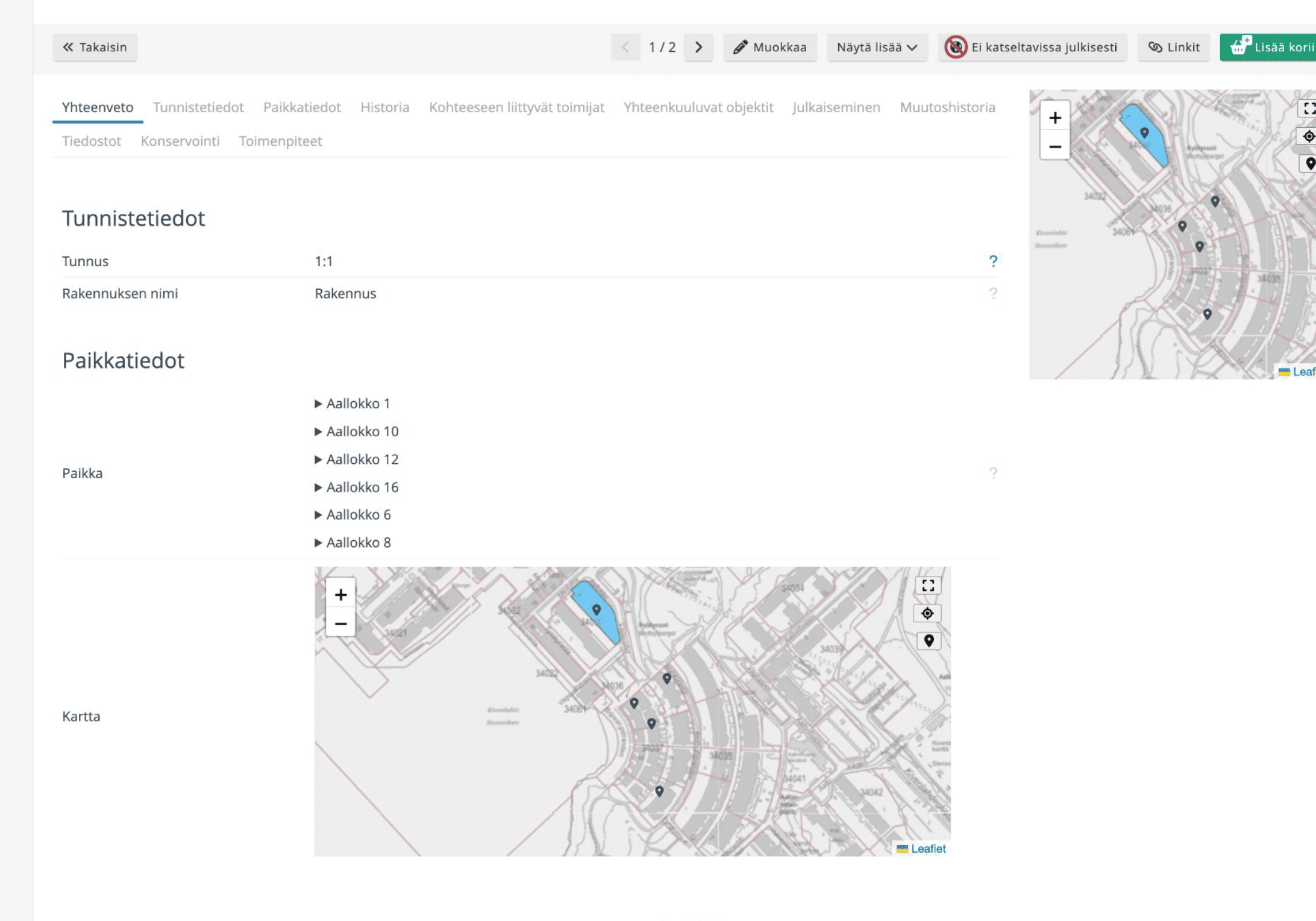
We helped Disec implement geospatial data visualisation in their Yksa collection management service.


Case Disec Oy
Mindhive’s work was of excellent quality – the code was clearly written and easy to understand. The end result met our client's needs perfectly.
Toni Säämänen
Product Manager
Disec Oy
Disec Oy specialises in digital collection management solutions. One of their key products is the Yksa service, which enables versatile and efficient collection management. One of Disec’s clients needed the ability to view geospatial data for buildings and areas directly in Yksa’s map interface.
Learn more
www.disec.fi
Where did we start

Need
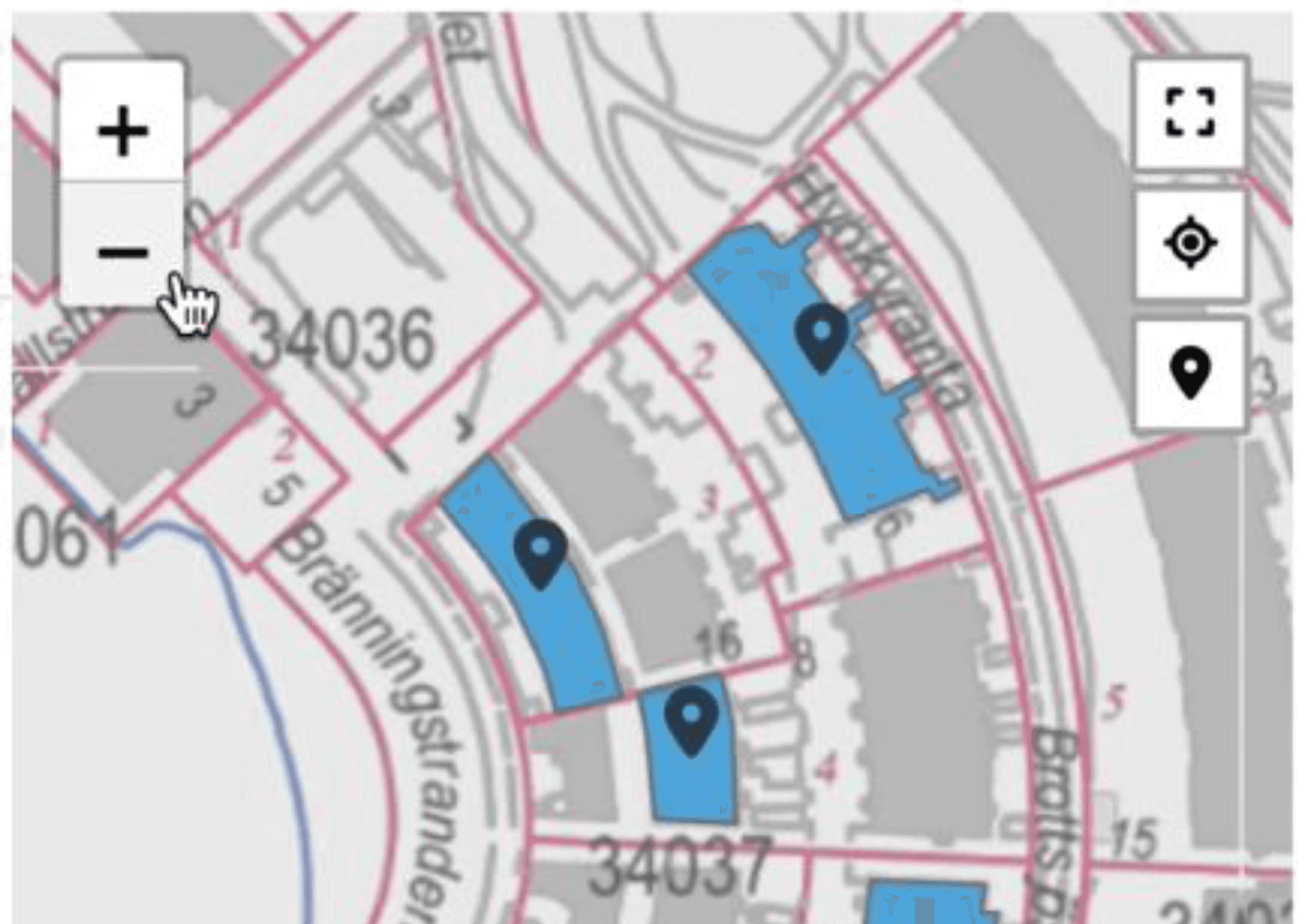
Disec Oy needed a solution for their SaaS service that would allow Yksa users to visualise geospatial data on a map. The goal was for users to view and manage collection items in a geographical context, such as seeing building locations and designated areas directly on a map.
Solution
We developed a fully configurable Vue component for the Yksa service, enabling map-based data visualisation within the platform. The component was integrated into the service with external API connections for retrieving geospatial data and maps, ensuring that the data is always up-to-date and accurate. With this solution, users can now view collection data on a map, significantly improving usability and offering additional value to Disec’s clients.
Goals
Agile development
Weekly meetings
Release
How did we do it
Versatile Vue component and API integrations
We developed a versatile and easily customisable Vue component that allowed for flexible and visually clear map-based data presentation. The component’s customisability enables it to be adapted for various needs without code changes. This means the map feature can be tailored to different client use cases. Special attention was given to ensuring that the component could efficiently handle large datasets, maintaining performance even when thousands of buildings are displayed in the same view.
To ensure that the geospatial data and maps are always current and accurate, we integrated the component with external APIs. These APIs automatically fetch the geospatial data and maps, guaranteeing a reliable and continuously updated data stream.
Agile development and close weekly follow-up
The project followed an agile development model, allowing for flexible and quick responses to the client’s changing needs. In weekly client meetings, our team reviewed project progress, presented development stages, and demoed the implemented solutions. This close collaboration ensured that development proceeded as planned, and we were able to address potential challenges quickly. As a result, the project was delivered on time and according to the client’s specifications.


What did our customer get
More efficient use of geospatial data
As a result of the project, Disec Oy’s Yksa service received a significant update that enables clear and intuitive visualisation of geospatial data on a map interface. This new functionality provides Disec’s clients with a clearer way to view location-related data.
This enhancement improves the service's usability, allowing geospatial data to be used more smoothly and efficiently.
Continuity and easy maintenance
The solution we developed not only met the client’s immediate needs but also ensured that the solution was well-documented and easy to understand. This guarantees that future development and maintenance of the service will be straightforward. The documentation was created in such a way that Disec’s own developers and maintenance team can take over the solution without extra learning, reducing maintenance costs and improving the longevity of the solution.

Need help with software development? Get in touch, and let’s find out how we can assist you.
Case Disec Oy
Mindhive’s work was of excellent quality – the code was clearly written and easy to understand. The end result met our client's needs perfectly.
Toni Säämänen
Product Manager
Disec Oy
Disec Oy specialises in digital collection management solutions. One of their key products is the Yksa service, which enables versatile and efficient collection management. One of Disec’s clients needed the ability to view geospatial data for buildings and areas directly in Yksa’s map interface.
Learn more
www.disec.fi
Where did we start


Need
Disec Oy needed a solution for their SaaS service that would allow Yksa users to visualise geospatial data on a map. The goal was for users to view and manage collection items in a geographical context, such as seeing building locations and designated areas directly on a map.
Solution
We developed a fully configurable Vue component for the Yksa service, enabling map-based data visualisation within the platform. The component was integrated into the service with external API connections for retrieving geospatial data and maps, ensuring that the data is always up-to-date and accurate. With this solution, users can now view collection data on a map, significantly improving usability and offering additional value to Disec’s clients.
Goals
Agile development
Weekly meetings
Release
How did we do it
Versatile Vue component and API integrations
We developed a versatile and easily customisable Vue component that allowed for flexible and visually clear map-based data presentation. The component’s customisability enables it to be adapted for various needs without code changes. This means the map feature can be tailored to different client use cases. Special attention was given to ensuring that the component could efficiently handle large datasets, maintaining performance even when thousands of buildings are displayed in the same view.
To ensure that the geospatial data and maps are always current and accurate, we integrated the component with external APIs. These APIs automatically fetch the geospatial data and maps, guaranteeing a reliable and continuously updated data stream.
Agile development and close weekly follow-up
The project followed an agile development model, allowing for flexible and quick responses to the client’s changing needs. In weekly client meetings, our team reviewed project progress, presented development stages, and demoed the implemented solutions. This close collaboration ensured that development proceeded as planned, and we were able to address potential challenges quickly. As a result, the project was delivered on time and according to the client’s specifications.


What did our customer get

More efficient use of geospatial data
As a result of the project, Disec Oy’s Yksa service received a significant update that enables clear and intuitive visualisation of geospatial data on a map interface. This new functionality provides Disec’s clients with a clearer way to view location-related data.
This enhancement improves the service's usability, allowing geospatial data to be used more smoothly and efficiently.
Continuity and easy maintenance
The solution we developed not only met the client’s immediate needs but also ensured that the solution was well-documented and easy to understand. This guarantees that future development and maintenance of the service will be straightforward. The documentation was created in such a way that Disec’s own developers and maintenance team can take over the solution without extra learning, reducing maintenance costs and improving the longevity of the solution.
